
Lands Minister Judith Nabakooba in the middle addressing residents of Kiganda Sub County in Kassanda District
The Ministry of Lands, Housing, and Urban Development require 63 Trillion Shillings to Map the entire country.
Dorcus Okalanyi, the Permanent Secretary in the Lands Ministry says obtaining the money at once is impossible because the ministry receives less than three trillion Shillings every financial year.
Okalanyi says that realizing the funds is achievable if the government and development partners provide 5 Trillion Shillings per year for the next 12 to 13 years.
Mapping involves identifying the exact coordinates of a piece or piece of land to determine its size and help in the recognition of owners and occupants in the case of mailo and customary land tenure systems.
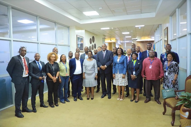
Okalanyi was speaking on Tuesday at the launch of a Knowledge Exchange Workshop, under the theme “Secure Land Rights-Learning, Collaboration and practice” at Imperial Golf View Hotel in Entebbe.
The workshop is organized under the Global Programmes “Responsible Land Policy” and “Strengthening Advisory Capacities for Land Governance in Africa”. The two programs are financed by the European Union and the government of Germany and implemented in 7 countries, which are Uganda, Ethiopia, Ivory Coast, Benin, Burkina Faso, and Madagascar.
In Uganda, the programme is being implemented in only four districts. They are Mubende, Mityana, Gomba and Kassanda.
Okalanyi noted that only 30 percent of the country’s land is mapped with a clear indication of size and ownership, making it difficult to resolve disputes of ownership and access in the case of mailo and customary land.
Judith Nabakooba, the Minister for Lands, Housing, and Urban Development, says the Global Programme on Land Policy has already registered successes in Uganda. She cited the increased land documentation, reduced gender-based violence, and land disputes since pro-poor technologies are being used to map land parcels.
“Conflicts are now resolved scientifically using Global Positioning System-GPS coordinates other than through primitive methods which included panga hacking, which used to result in death, injury and imprisonment of families involved in land conflicts,” she noted.
She added that the majority of the beneficiaries, estimated at close to 400,000 in Uganda namely Eastern and Northern Uganda, are women and children who are now protected since their names are on the customary land titles or certificates of occupancy which guarantee them a future.
She says the cost of mapping the entire country can be reduced if the ministry, landlords, and tenants map out land sub-county by sub-county instead of deploying surveyors who are inadequate and also expensive.
Nabakooba also wants land officers to involve communities including landlords who initially resisted the exercise in the four pilot districts to map out each sub-county instead of partial mapping.
Nabakooba says the ministry will continue to lobby for additional funds from the government and development partners to ensure the Global Program on Land Policy is rolled out across the country in a phased manner.
Klaus Ackermann, the Head of the Global Program responsible for Land Policy, says that the development partners have invested about 395 Billion Shillings for the effective implementation of the program.
Ackermann however says governments must mobilize additional funds to roll out the programs nationwide.
The German Federal Ministry of Economic Cooperation and Development (BMZ) commissioned GIZ in November 2015 to implement the two global programs with the overall aim of reducing poverty and improving food security in rural areas. The two global programs are also part of the No Hunger Initiative.
-URN